Our research involves developing mathematical and computer models of marine systems. The systems we research encompass a wide range of scales; a single particle of marine detritus sinking on the ocean and the biological, physical, and chemical processes that affect it as it sinks; the growth of plants in a coastal seagrass bed or a salt marsh; the fate of carbon in the global ocean. We work very closely with field and laboratory scientists, exchanging information so as to improve the predictive ability of our models and our understanding of the systems we are investigating.
Aggregation and Sedimentation of Marine Snow and Oil
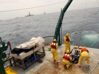
Oil from natural sources or from an oil spill can interact and aggregate with naturally occurring particles such as suspended sedimentary particles, algal cells, or detrital material. Large aggregates, commonly called marine snow can sink through the water column, taking any oil they contain with them. We are part of a Gulf of Mexico Research Initiative to develop predictive models of aggregation between oil and marine particles so that we can better understand the flux of oil from the surface to the sea floor. This project involves an interdisciplinary team using field data, laboratory experiments, and computer modeling to improve our understanding of the fate of oil in the marine environment. Visit here to learn more about this project.
Modeling Salt Marshes
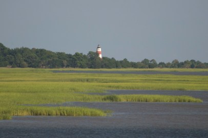
Salt marshes are a common feature in coastal areas, providing habitat for a diverse range of plants, animals, birds, fish, and even microbes. Physical protection against storms is one of the many useful services that salt marshes provide us. Our group is an active part of the Georgia Coastal Ecosystems Long Term Ecological Research (GCE-LTER) Project based on Sapelo Island, Georgia, USA. For this project we are modeling plant growth and production as well as studying climatic influences on the ecosystem. To learn more about the GCE-LTER, visit here.
Relating Carbon Export to Remotely Sensed Optical Properties

The oceans take up approximately half of the carbon dioxide that humans emit into the Earth’s atmosphere. Microscopic algal cells in the surface waters take up that carbon and a fraction of this sinks into the deep ocean as biological detritus. Some of this sinking carbon reaches sufficient depths that it is effectively sequestered by the oceans for long periods of time. Satellites can be used to provide global maps of the surface algal biomass and production, but cannot see deeper into the ocean to measure this sinking carbon. We are part of the NASA-funded EXPORTS program which aims to develop linkages between the signals that satellites can detect and the carbon sinking in the deep ocean. Visit here to learn more about the EXPORTS program.
